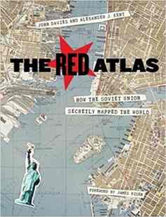
From 1950 to 1990, the Soviet Army conducted a global topographic mapping program, creating large-scale maps for much of the world that included a diversity of detail that would have supported a full range of military planning. For big cities like New York, DC, and London to towns like Pontiac, MI and Galveston, TX, the Soviets gathered enough information to create street-level maps. What they chose to include on these maps can seem obvious like locations of factories and ports, or more surprising, such as building heights, road widths, and bridge capacities. Some of the detail suggests early satellite technology, while other specifics, like detailed depictions of depths and channels around rivers and harbors, could only have been gained by actual Soviet feet on the ground. The Red Atlas includes over 350 extracts from these Cold War maps, exploring their provenance and cartographic techniques as well as what they can tell us about their makers and the Soviet initiatives that were going on all around us.
About the Author
John Daviesis a British map collector and enthusiast. He encountered Soviet mapping whilst working in Latvia in early 2000s. Since retiring from a career in Information Systems he has been writing and lecturing about these maps and is editor of Sheetlines, the Journal of The Charles Close Society for the Study of Ordnance Survey Maps. He lives in London and runs the websitehttp://redatlasbook.com/
Please use your Email instead of your Username to login.
Caution: Deleting Your Account will permanently remove all associated data, which cannot be recovered.
Your cart's total less than the Gift Card value. If you checkout now, the remaining amount will elapse as Gift Cards are for one time use only. Continue Shopping to fully consume your Gift Card.
The Transaction was unsuccessfull. Please try again.
 0
0
 0
0